

Layers
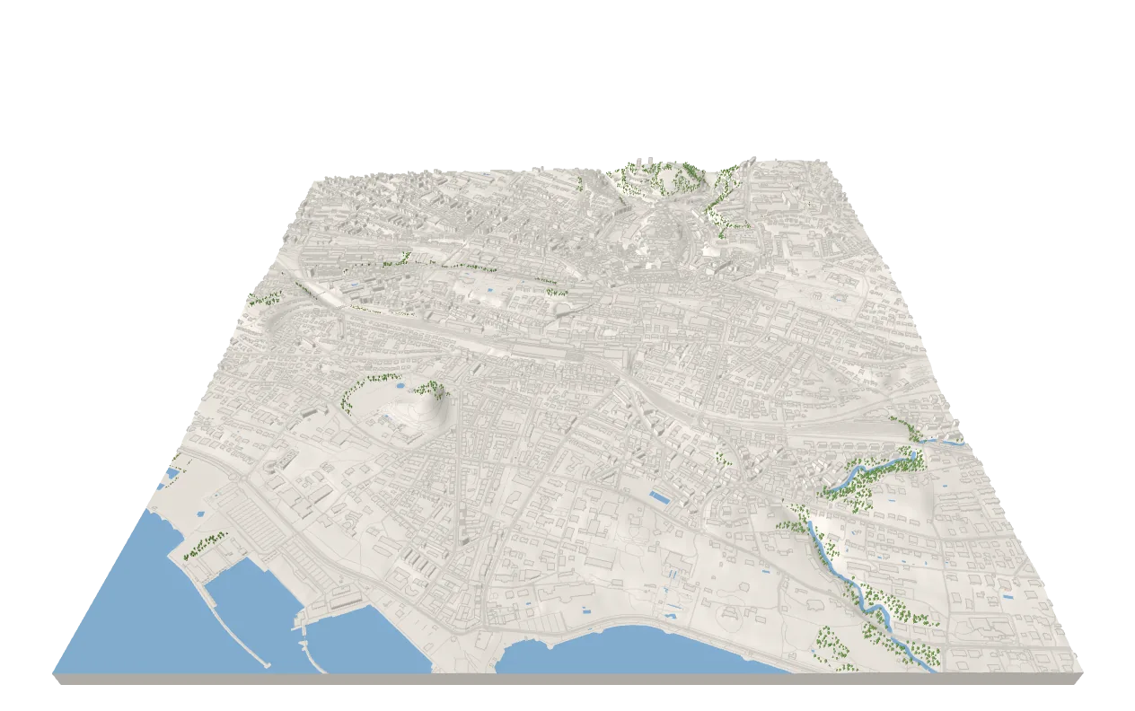
Buildings, roads, water, vegetation and the base are layers of the map: they follow its tiles as they load, take on its look and go into its exports. They need a city-scale zoom — 14 to 16; at 15 a 3 × 3 grid is about 2.5 km wide — and true scale, so that they are not flattened. Lausanne with every layer; a click highlights the building or road under the pointer:
import {  Buildings,  Map,  Roads,  TerrainBase,  Vegetation,  Water} from 'three-map-terrain'
import type { Demo } from './stage'
// Lausanne with every layer, from OpenFreeMap; a click highlights the// building or road under the pointerconst lausanne: Demo = ({ scene, camera, controls, onClick, status }) => {  const map = new Map({    location: { lat: 46.515, lon: 6.632 },    elevation: { api: 'mapterhorn' },    options: {      zoom: 15,      tileSegments: 64, // plenty at city zooms      exaggeration: 1, // true to scale      baseAltitude: 372 // Lake Geneva at z = 0    },    material: { color: '#f2ede5' } // no imagery: a plain model  })  // all read the OpenFreeMap tiles, loaded once  const buildings = map.addLayer(    new Buildings({ source: { api: 'openfreemap' }, edges: true })  )  const roads = map.addLayer(new Roads({ source: { api: 'openfreemap' } }))  const water = map.addLayer(new Water({ source: { api: 'openfreemap' } }))  map.addLayer(    new Vegetation({      source: { api: 'openfreemap' },      avoid: [water, roads, buildings] // not in the lake, on roads, in houses    })  )  map.addLayer(new TerrainBase())  scene.add(map.terrain)  void map.init()
  map.focus = controls.target // layers draw what the camera looks at first  camera.position.set(0, -1600, 1250)
  status('Click a building or a road')  onClick((raycaster) => {    const building = buildings.pick(raycaster)    const road = building ? undefined : roads.pick(raycaster)    buildings.highlight(building?.feature)    roads.highlight(road?.feature)    if (building) {      const { height } = building.feature      status(height ? `A building, ${Math.round(height)} m high` : 'A building')    } else if (road) {      const { kind, bridge } = road.feature      status(bridge ? `A ${kind} bridge` : `A ${kind} road`)    } else status('Click a building or a road')  })  return map}
export default lausanne
map.addLayer() returns the layer; layers using the same preset — here OpenFreeMap — share its tiles, loaded and decoded once. pick(raycaster) returns { feature, lat, lon, alt, point } of the feature under the ray, never one the terrain hides, and highlight(feature) draws it over any material.
With React Three Fiber, a pointer event is already an intersection: buildings.pickIntersection(event); roads, which lie on the terrain, are picked with the event’s ray: roads.pick(new Raycaster(event.ray.origin, event.ray.direction)).
Layers draw their tiles a few at a time between frames, across every layer — so that the data arriving at once never holds up a frame — the nearest to map.focus first: by default the location, or a point you keep, in world coordinates:
map.focus = camera.position // or controls.target: followed as it movesThe layers
Section titled “The layers”| Layer | Draws |
|---|---|
Buildings |
Footprints extruded on the terrain: walls, roofs, floors, edges |
Roads |
Roads and railways lying on the terrain; bridges as decks on piers |
Water |
Lakes, the sea and rivers lying on the terrain; waterways as ribbons |
Vegetation |
Woods of trees and scrub of bushes, single trees and bushes — or what you plant |
TerrainBase |
Side walls and a bottom: the terrain as a solid block |
FeatureLayer |
Your own: any source, your geometry, kept in step with the terrain |
Each takes a source — a preset, vector tiles of yours, Overpass or a load of your own (Sources) — a material (Materials), a build to replace or extend its geometry (Your own layers), and maxDistance to hide it far from the camera (Performance). Their shared members are in the reference.